
Renewable Energy Engineering
[1]

The use of photovoltaic (PV) panels has increased rapidly in the last few years and as a result has become one of the main sources of renewable energy. In this context, it is important to understand in detail how a PV panel reacts to different environmental conditions and how these affect total performance. An experiment has been designed to investigate the performance of a PV panel under various highly non-uniform temperature and irradiance profiles, generated by artificial lighting. Measurements of irradiance and temperature distribution are related to measured I–V curves and used as input to the five-parameter model. The results show the limitations of the model to emulate the PV response under such extreme conditions and provide useful insights about the effect of the temperature profile on the PV performance.
[2]
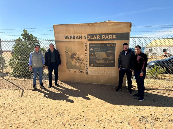
A site visit was held in CiROCCO’s Pilot 1 location in Benban, Aswan, Egypt; by the presence of Dr. Omar Elbadawy from CEDARE, Dr. Panagiotis Kosmopolos from NOA and the Benban Solar Developers Association to evaluate the site and collect the needed data to determine the sensing nodes location for future site observations.
[3]

This study deals with the effect of clouds and aerosols on solar photovoltaic energy in the urban environments and conditions of Athens, Cairo, Granada and Vienna, so that there is diversity in terms of cloud presence, aerosol types and irradiation levels. To this direction, satellite-based remote sensing data were used for a decade (2010–2019) from Eumetsat in conjunction with Copernicus and radiative-transfer-modelled data. Furthermore, an idealized solar energy planning scenario, making the most of photovoltaics installed on the roofs of city buildings, was investigated in order to cover the electricity needs of the pilot cities and to promote local energy security and transition.
[4]

We investigate the possibility of estimating global horizontal irradiance (GHI) in parallel to photovoltaic (PV) power production in India using a radiative transfer model (RTM) called libRadtran fed with satellite information on the cloud and aerosol conditions. For the assessment of PV energy production, we exploited one year’s (January–December 2018) ground-based real-time measurements of solar irradiation GHI via silicon irradiance sensors (Si sensor), along with cloud optical thickness (COT). The data used in this method was taken from two different sources, which are EUMETSAT’s Meteosat Second Generation (MSG) and aerosol optical depth (AOD) from Copernicus Atmospheric Monitoring Services (CAMS). The COT and AOD are used as the main input parameters to the RTM along with other ones (such as solar zenith angle, Ångström exponent, single scattering albedo, etc.) in order to simulate the GHI under all sky, clear (no clouds), and clear-clean (no clouds and no aerosols) conditions. This enabled us to quantify the cloud modification factor (CMF) and aerosol modification factor (AMF), respectively. Subsequently, the whole simulation is compared with the actual recorded data at four solar power plants, i.e., Kazaria Thanagazi, Kazaria Ceramics, Chopanki, and Bhiwadi in the Alwar district of Rajasthan state, India. The maximum monthly average attenuation due to the clouds and aerosols are 24.4% and 11.3%, respectively. The energy and economic impact of clouds and aerosols are presented in terms of energy loss (EL) and financial loss (FL). We found that the maximum EL in the year 2018 due to clouds and aerosols were 458 kWh m−2 and 230 kWh m−2, respectively, observed at Thanagazi location. The results of this study highlight the capabilities of Earth observations (EO), in terms not only of accuracy but also resolution, in precise quantification of atmospheric effect parameters. Simulations of PV energy production using EO data and techniques are therefore useful for real-time estimates of PV energy outputs and can improve energy management and production inspection. Success in such important venture, energy management, and production inspections will become much easier and more effective.
[5]

This study estimates the photovoltaic (PV) energy production from the rooftop solar plant of the National Institute of Technology Karnataka (NITK) and the impact of clouds and aerosols on the PV energy production based on earth observation (EO)-related techniques and solar resource modeling. The post-processed satellite remote sensing observations from the INSAT-3D have been used in combination with Copernicus Atmosphere Monitoring Service (CAMS) 1-day forecasts to perform the Indian Solar Irradiance Operational System (INSIOS) simulations. NITK experiences cloudy conditions for a major part of the year that attenuates the solar irradiance available for PV energy production and the aerosols cause performance issues in the PV installations and maintenance. The proposed methodology employs cloud optical thickness (COT) and aerosol optical depth (AOD) to perform the INSIOS simulations and quantify the impact of clouds and aerosols on solar energy potential, quarter-hourly monitoring, forecasting energy production and financial analysis. The irradiance forecast accuracy was evaluated for 15 min, monthly, and seasonal time horizons, and the correlation was found to be 0.82 with most of the percentage difference within 25% for clear-sky conditions. For cloudy conditions, 27% of cases were found to be within ±50% difference of the percentage difference between the INSIOS and silicon irradiance sensor (SIS) irradiance and it was 60% for clear-sky conditions. The proposed methodology is operationally ready and is able to support the rooftop PV energy production management by providing solar irradiance simulations and realistic energy production estimations.
[6]

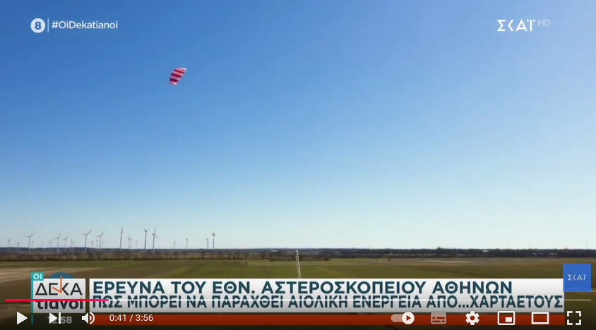
Wind power can significantly contribute to the transition from fossil fuels to renewable energies. Airborne Wind Energy (AWE) technology is one of the approaches to tapping the power of high-altitude wind. The main purpose of a ground-based kite power system is to estimate the tether force for autonomous operations. The tether force of a particular kite depends on the wind velocity and the kite’s orientation to the wind vector in the figure-eight trajectory. In this paper, we present an experimental measurement of the pulling force of an Airush Lithium 12 m2 kite with a constant tether length of 24 m in a coastal region. We obtain the position and orientation data of the kite from the sensors mounted on the kite. The flight dynamics of the kite are studied using multiple field tests under steady and turbulent wind conditions. We propose a physical model (PM) using Artificial Neural Network (ANN) and Long Short-Term Memory (LSTM) deep neural network algorithms to estimate the tether force in the experimental validation. The performance study using the root mean square error (RMSE) method shows that the LSTM model performs better, with overall error values of 126 N and 168 N under steady and turbulent wind conditions.
[7]

A Kite-based Airborne Wind Energy Conversion System (KAWECS) works by harnessing the kinetic energy from the wind and converting it into electric power. The study of the dynamics of KAWECS is fundamental in researching and developing a commercial-scale KAWECS. Testing an actual KAWECS in a location with suitable wind conditions is only sometimes a trusted method for conducting research. A KAWECS emulator was developed based on a Permanent Magnet Synchronous Machine (PMSM) drive coupled with a generator to mimic the kite’s behaviour in wind conditions. Using MATLAB-SIMULINK, three different power ratings of 1 kW, 10 kW, and 100 kW systems were designed with a kite surface area of 2.5 m2, 14 m2, and 60 m2, respectively. The reel-out speed of the tether, tether force, traction power, drum speed, and drum torque were analysed for a wind speed range of 2 m/s to 12.25 m/s. The satellite wind speed data at 10 m and 50 m above ground with field data of the kite’s figure-of-eight trajectories were used to emulate the kite’s characteristics. The results of this study will promote the use of KAWECS, which can provide reliable and seamless energy flow, enriching wind energy exploitation under various installation environments.
[8]

Airborne wind energy systems (AWES) are more efficient than traditional wind turbines because they can capture higher wind speeds at higher altitudes using connected kite generators. Securing a real wind turbine or a site with favorable wind conditions is not always an assured opportunity for conducting research. Hence, the Research and Development of the Laboratory Scale Airborne Wind Energy Conversion System (LAWECS) require a better understanding of airborne wind turbine dynamics and emulation. Therefore, an airborne wind turbine emulation system was designed, implemented, simulated, and experimentally tested with ground data for the real time simulation. The speed and torque of a permanent magnet synchronous motor (PMSM) connected to a kite are regulated to maximize wind energy harvesting. A field-oriented control technique is then used to control the PMSM’s torque, while a three-phase power inverter is utilized to drive the PMSM with PI controllers in a closed loop. The proposed framework was tested, and the emulated airborne wind energy conversion system results were proven experimentally for different wind speeds and generator loads. Further, the LAWECS emulator simulated a 2 kW, 20 kW, and 60 kW designed with a projected kite area of 5, 25, and 70 square meters, respectively. This system was simulated using the Matlab/Simulink software and tested with the experimental data. Furthermore, the evaluation of the proposed framework is validated using a real-time hardware-in-the-loop environment, which uses the FPGA-based OPAL-RT Simulator.
[10]

The energy utilization of the transportation industry is increasing tremendously. The battery is one of the primary energy sources for a green and clean mode of transportation, but variations in driving profiles (NYCC, Artemis Urban, WLTP class-1) and higher C-rates affect the battery performance and lifespan of battery electric vehicles (BEVs). Hence, as a singular power source, batteries have difficulty in tackling these issues in BEVs, highlighting the significance of hybrid-source electric vehicles (HSEVs). The supercapacitor (SC) and photovoltaic panels (PVs) are the auxiliary power sources coupled with the battery in the proposed hybrid electric three-wheeler (3W). However, energy management strategies (EMS) are critical to ensure optimal and safe power allocation in HSEVs. A novel adaptive Intelligent Hybrid Source Energy Management Strategy (IHSEMS) is proposed to perform energy management in hybrid sources. The IHSEMS optimizes the power sources using an absolute energy-sharing algorithm to meet the required motor power demand using the fuzzy logic controller. Techno-economic assessment wass conducted to analyze the effectiveness of the IHSEMS. Based on the comprehensive discussion, the proposed strategy reduces peak battery power by 50.20% compared to BEVs. It also reduces the battery capacity loss by 48.1%, 44%, and 24%, and reduces total operation cost by 60%, 43.9%, and 23.68% compared with standard BEVs, state machine control (SMC), and frequency decoupling strategy (FDS), respectively.

[12]

The sun is an abundant source of energy, and solar energy has been at the forefront of the renewable energy sector for years. A way to convert it into electricity is by the use of solar cells. Multiple solar cells, connected to each other, create solar panels, which in their turn, are connected in a solar string, and they create solar farms. These structures are extremely efficient in electricity production, but also, cells are fragile in nature and delicate to environmental conditions, which is the reason why some of them show discrepancies and are called defective. In this research, a thermal camera mounted on a drone has been used for the first time in the solar farm operating conditions of India in order to capture images of the solar field and investigate solar panels for defective cells and create an orthomosaic image of the entire area. This procedure next year will be established on an international scale as a best practice example for commercialization, providing effortless photovoltaic monitoring and maintenance planning. For this process, an open source software WebODM has been used, and the entire field was digitized so as to identify the location of defective panels in the field. This software was the base in order to provide and analyze a digital twin of the studied area and the included photovoltaic panels. The defects on solar cells were identified with the use of thermal bands, which record and point out their temperature of them, whereas anomalies in the detected temperature in defective solar cells were captured using thermal electromagnetic waves, and these areas are mentioned as hotspots. In this research, a total number of 232.934 solar panels were identified, and 2481 defective solar panels were automatically indicated. The majority of the defects were due to manufacturing failure and normal aging, but also due to persistent shadowing and soiling from aerosols and especially dust transport, as well as from extreme weather conditions, including hail. The originality of this study relies on the application of the proposed under development technology to the specific conditions of India, including high photovoltaic panels wear rates due to extreme aerosol loads (India presents one of the highest aerosol levels worldwide) and the monsoon effects. The ability to autonomously monitor solar farms in such conditions has a strong energy and economic benefit for production management and for long-term optimization purposes.